For years, Coconut Creek staff has looked for a way to share current and upcoming projects with residents. They experimented with tables and online portals, but, says Sustainable Development Director Sheila Rose, they were never user-friendly.
Recently, the city introduced a solution: a web application from ESRI, a digital mapping company whose software is used by about 350,000 organizations to organize and display data. The labeled map platform, called Story Map, has also been used by the city of Boston, the National Parks Conservation Association and other organizations.
The idea to use Story Map came from Ken Brown, the city’s GIS coordinator. (GIS stands for geographic information system.) Brown has been the lead on the project, to which other city departments contribute, including Sustainable Development, Public Works, Engineering and Utilities, and Parks and Recreation.
“We started using this app when we were working on trying to create an interactive public art master plan to get the word out about our public art,” says Rose, who is also Assisant City Manager. “It showed itself to be such a valuable user-friendly tool that it’s expanded into all these other projects.”
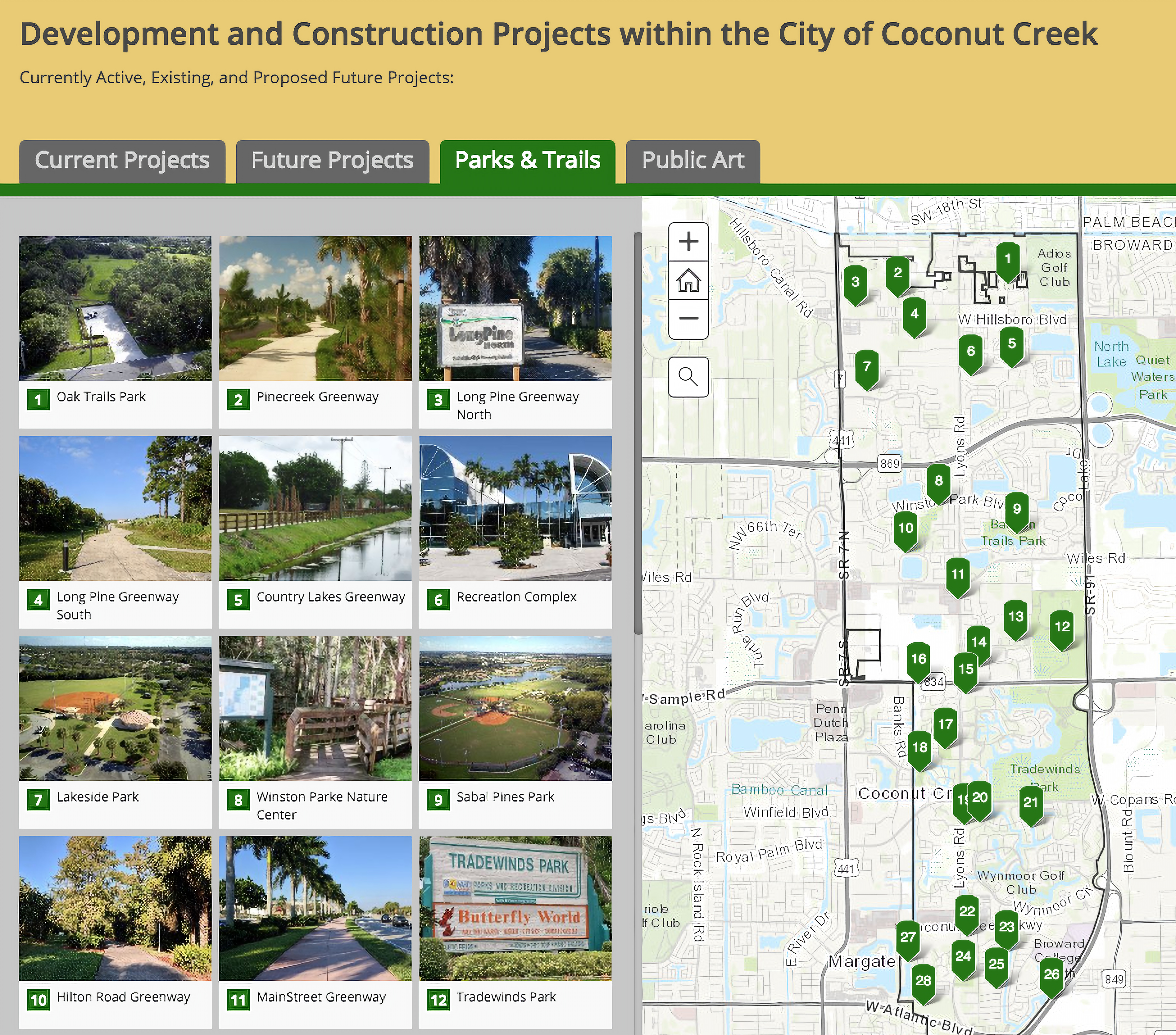
The Story Map includes tabs for current projects (most of which are in construction or in progress), future projects (most of which are going through different phases of the approval and building process), parks and trails, and public art. [Editor’s Note: The parks and trails tab is pictured on the opposite page.] Users are able to click on the tabs to see the locations of the corresponding projects and places. Clicking on numbers on the map or clicking on the project guide beside the map shows more information about the project. For instance, clicking on the public art tab, and then clicking on No. 6, shows a photo and information on “The Champion,” a sculpture outside of American Top Team. The map is simple to view on a variety of devices, including smartphones, tablets and desktops.
Rose describes the map as a public education tool that can teach residents more about the city.
“We’ve taken bus tours with residents from Wynmoor, from the Township, and they’re always surprised by what is in Coconut Creek,” Rose says. “There are so many beautiful things that you want people to experience, but they don’t know that they’re there. [For] getting the word out, it’s a really valuable tool.”
While there are no current plans to add tabs, the city is open to suggestions. Rose encourages user feedback through social media, email or phone. (Residents can call the Sustainable Development Department at 954.973.6756.)
“The value of the product will be in how much time we take in making sure the information is up to date and we’re committed to do that,” Rose says.
Explore Coconut Creek’s Story Map at arcg.is/1Xaarz.
Coconut Creek Lifestyle asked Rose to share details about some of the projects Creek residents can look forward to.
Clarity Pointe
What: A 42,750-square-foot, two-floor memory-care assisted-living facility with 84 beds.
Location: 5461 Johnson Road.
In the Pines Townhomes
What: 55 townhouses featuring two- and three-bedroom models with one- or two-car garages and amenities.
Location: The southeast corner of Hillsboro Boulevard and NW 51st Terrace; adjacent to the city’s Long Pines Greenway.
I am text block. Click edit button to change this text. Lorem ipsum dolor sit amet, consectetur adipiscing elit. Ut elit tellus, luctus nec ullamcorper mattis, pulvinar dapibus leo.
Eden at Coconut Creek
What: Six single-family homes on two acres. Two models (both around 2,600 square feet) feature garage and patio areas. Will be built with structural insulated panels that provide hurricane safety and high insulation.
Location: On Coconut Creek Boulevard, near Broward College.


